21 earthquakes in La Palma and one of 3.1 magnitude south of Gran Canaria
- 02-10-2021
- National
- Canarian Weekly
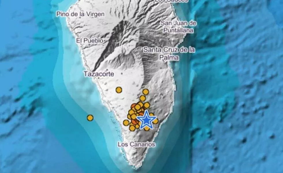
The IGN has given an update of seismic activity registered in the Canary Islands over the last 24 hours, with 21 earthquakes registered in La Palma in the surrounding areas of the eruption of the Cumbre Vieja volcano, two of which were felt by the public, and one off the south coast of Gran Canaria.
The highest magnitude recorded is 3.6 on the Richter scale corresponding to the earthquake felt with a maximum intensity close to the main volcano at 2:13pm yesterday afternoon. Another quake was measured at a magnitude of 3.0 in the municipality of Villa de Mazo at a depth of 13 kilometres at 6:56am this morning, but was not felt by the public.
According to data from the IGN, the volcanic tremor signal maintains its stable level similar to those of the previous days in a range of average values with respect to those observed since the beginning of the eruption, although two earthquakes have also been located at depths of around 30 kilometres, as well as a shallow earthquake in the area near the main cone.
The rest of the earthquakes, were located in Fuencaliente, and occurred between 1 and 15 kilometres deep. The last of them measured 2.2 and took place at 9:01am at a depth of 7 kilometres in the northeast of Fuencaliente.
Gran Canaria registered an earthquake of 3.1 degrees on the Richter scale at 4.23am this morning near the southern coast of the island in the sea. The previous earthquake to this one was at the beginning of the week in the north of the island, on land in the municipality of Santa María de Guía.
The IGN has also reported that the network of permanent GNSS stations in La Palma show a return to stability in deformations of the landscape.
The IGN continues to monitor volcanic activity and has strengthened its surveillance network on La Palma, where it has established an Eruption Attention and Surveillance Centre and works daily to collect samples of volcanic material for analysis.


