The ‘new land’ created by the lava from the volcano now measures 27.7 hectares
- 02-10-2021
- National
- Canarian Weekly
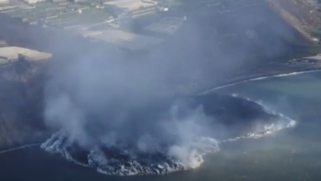
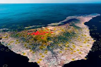
The lava flows from the Cumbre Vieja volcano in La Palma reached the sea on Tuesday night after ten days of the eruption. The lava flowed through the municipalities of El Paso, Los Llanos de Aridane and Tazacorte, where it finally collided with the salty water after falling down a cliff almost 100 meters high. Since then the volvanic material has formed a lava delta or ‘fajana’, which now occupies almost 500 metres of the coastline, reaches a height of 30 metres and extends over an area of 27.7 hectares, the equivalent of almost 28 football pitches.
What is a fajana?
The word ‘fajana’ is a Canarian term that the Royal Academy of the Spanish Language (RAE) defines as "land at the foot of slopes or escarpments, commonly formed by materials detached from the heights that dominate it."
The Canarian Academy of Language specifies that it is a "flat terrain at the foot of the slopes, escarpments or bends of ravines, commonly formed by materials detached from the heights that dominate it, or washed away by the waters."
How are they formed?
When lava hits seawater it begins to solidify rapidly as more volcanic material continues to pile up on top. The accumulation of lava is gaining ground at the coast in the form of a fan as it opens out to the sea.
Are there more fajanas in the Canary Islands?
In La Palma there are already the Franceses and Barlovento fajanas. In addition, on the coast of Tazacorte there is one created by the San Juan volcano in 1949. This area was covered with several metres of land up to the top of palm trees, and became one of the best enclaves for the cultivation of bananas in the Archipelago.
On many occasions, tidal pools form in the fajanas, for example in the natural pools of Las Calcosas, in El Hierro. In Tenerife there is a fajana in Punta del Hidalgo; in Gran Canaria, in the Barranco de Cardones; in Fuertevenura, on the coast of Jacomar; and in Lanzarote they can be seen along almost its entire coast, due to the Timanfaya eruption, which began on September 1st 1730 and lasted for six years.
Who owns the new land?
The land that the lava is forming in the sea is automatically in the public land maritime domain, that is to say, property of the State. It is part of the national geological heritage and is subject to the Natural Heritage and Biodiversity Laws. The Coastal Law establishes that any land or islands that are formed by natural causes in the sea belong to the state maritime terrestrial public domain.
Is the formation of these coastal areas dangerous?
When the lava reaches the ocean it stays at around 1,000°C, while the sea temperature is just 20°C. This temperature difference generates columns of water vapour loaded with hydrochloric acid as a consequence of the significant chloride content in saltwater.
In addition, the plumes contain tiny particles of volcanic ‘glass’ as a result of the reaction between lava and seawater. This vapour poses a danger to people who visit or live in the affected area, and the wind in the area contributes to the dispersion of the gases. Inhalation or contact with these elements irritate the skin, eyes and respiratory tract, and can cause breathing difficulties,
What precautions should be taken?
It is essential that those who approach the emission zone or live in the closest areas use FFP2 type masks; keep windows and doors closed with a damp cloth in the gaps around them; and avoid using air conditioners that are powered from outside and draw air inside.
Other articles that may interest you...
Trending
Most Read Articles
Featured Videos
TributoFest: Michael Buble promo 14.02.2026
- 30-01-2026
TEAs 2025 Highlights
- 17-11-2025


