
SUNDAY WEATHER: A cooler unsettled day as storms approach the Canary Islands

The Canary Islands are in for an unsettled day today, Sunday 1st November, as a low-pressure system brings rain and the possibility of thunderstorms to the archipelago.
The Canary Islands Government has upgraded its warning to a rain alert for the Tenerife metropolitan area and the west and peaks of La Palma. The alert came into force at midnight and was brought forward from the original start time announced yesterday.
The rest of Tenerife and La Palma, along with Gran Canaria, La Gomera and El Hierro, remain on rain pre-alert. A separate thunderstorm pre-alert also covers the four western islands and northern Gran Canaria.
The heaviest rain is expected in the Tenerife metropolitan area and parts of La Palma, where up to 30mm could fall in an hour. Showers may be unevenly distributed, and the forecast could change as the system moves.
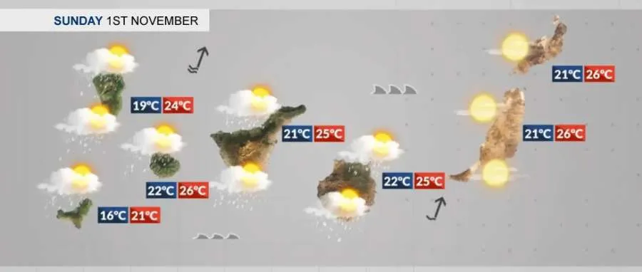
Forecast for all of the islands for Sunday 1st November:
TENERIFE
Tenerife will be cloudy or overcast, with occasional showers that could become locally heavy, particularly from around midday. The northeast and metropolitan area face the greatest risk of intense or persistent rain, possibly accompanied by thunderstorms.
The rain alert covers the metropolitan area, while the rest of the island is on pre-alert. The Cabildo has announced that Anaga’s trails and several venues in the affected area will close from 10.00am today as a precaution, and CDT Tenerife’s game against Andorra tonight has been postponed.
In the south, temperatures are forecast to be between a cool 19–22°C during the day, with showers possible. Winds will generally be light near the coast but stronger in the mountains and around the central peaks.
GRAN CANARIA
Gran Canaria can expect cloudy skies and showers, which may become locally heavy, particularly in the north from midday. Thunderstorms are also possible.
The island is on rain pre-alert, with a thunderstorm pre-alert covering the north. Conditions may differ considerably between the north, the mountains and southern resorts.
In southern resorts, temperatures are forecast to range from around 21°C this morning to 25°C during the day. Winds will be mainly easterly, with stronger south-westerly winds in the higher areas.
LANZAROTE
Lanzarote will have a cloudy or overcast day, with occasional showers possible. Some light calima may also leave the sky looking hazy.
In Puerto del Carmen, temperatures are forecast to be around 21–25°C during the day. Winds will generally be light to moderate from the east.
Lanzarote is not included in the current regional rain alert or pre-alert. The government says the heaviest part of the episode is not expected to extend significantly to the eastern islands, although the situation will continue to be monitored.
FUERTEVENTURA
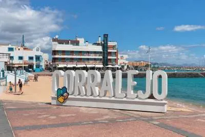
Fuerteventura is also expected to see plenty of cloud, with occasional showers possible during the day. Light calima may remain present in some areas.
Across the island, forecast temperatures are around 20–24°C, with local differences between the coast and inland areas. Winds will be mainly easterly and moderate.
Fuerteventura is not currently included in the regional rain alert or pre-alert, but residents and holidaymakers should still be prepared for a changeable day.
Share: