Pre-alert declared for dangerous coastal waters across the Canary Islands
- 26-11-2024
- National
- Canarian Weekly
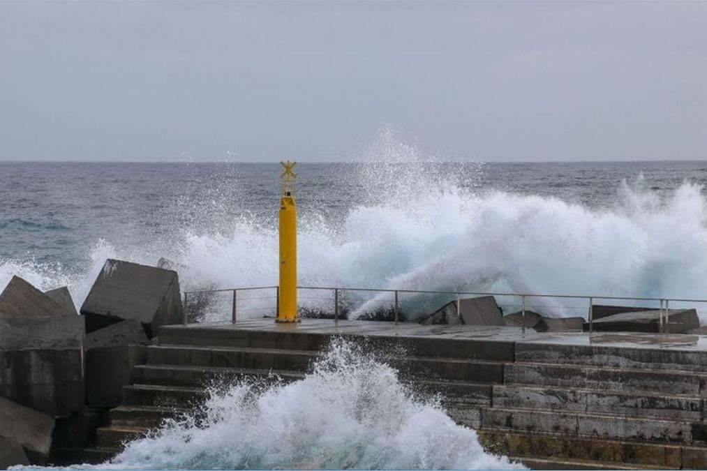
- Photo Credit: 112 Canarias
The Directorate General of Emergencies for the Canary Islands has declared a pre-alert for coastal phenomena from 8:00am this morning (Tuesday), affecting the northern and western coasts of all the islands.
The alert is activated following predictions from the State Meteorological Agency (AEMET) and other weather sources, in line with the Canary Islands’ Specific Emergency Plan for Adverse Meteorological Risks (PEFMA).
Affected Areas
The pre-alert covers the northern and western coasts of the islands of Fuerteventura, Lanzarote, La Palma, La Gomera, and El Hierro, as well as the northern shores of Tenerife and Gran Canaria.
AEMET has forecast winds from the east and northeast ranging from 6–19 km/h, with occasional gusts of 20–28 km/h. Sea conditions include choppy waters and northwesterly swells reaching 1.5–3.5 metres. Combined waves on northern and western coasts could reach 2.5–3.5 metres. High tides are expected during the following hours:
- Tuesday (November 26th): 9:55–10:30am and 10:20–10:55pm.
- Wednesday (November 27th): 10:30–11:05am and 11:00–11:30pm.
End of Rain Alerts
The Government has officially ended the rain alert in La Palma and pre-alert in the other islands, signalling a shift in emergency focus towards coastal safety.
Safety Recommendations
The Directorate General of Emergencies urges residents and visitors to adhere to the following safety guidelines:
- Avoid standing at the edge of piers or breakwaters, especially for photos or videos.
- Refrain from fishing in risky areas.
- Do not drive along roads near the shoreline during hazardous conditions.
- Avoid swimming at remote or unfamiliar beaches, as local currents may pose a danger.
- Heed red-flag warnings at beaches and avoid areas with strong surf or no lifeguard services.
- Refrain from water sports or camping on affected beaches.
- Stay clear of the sea if wave activity appears abnormal, even if conditions temporarily calm.
- Warn others if they appear to be in danger and call emergency services if needed.
If Caught in Dangerous Waters:
- Move away from breaking waves and signal for help.
- Stay calm and avoid swimming against the current; let it carry you to a point where the flow weakens before attempting to swim to safety.
- On land, assist others by throwing flotation devices and calling emergency services immediately (1-1-2).
Residents and visitors are strongly encouraged to follow these guidelines to ensure safety during the coastal alert period.
Other articles that may interest you...
Trending
Most Read Articles
Featured Videos
TributoFest: Michael Buble promo 14.02.2026
- 30-01-2026
TEAs 2025 Highlights
- 17-11-2025


