The first week of June will bring rain to the Canary Islands
- 01-06-2023
- National
- AEMET .
- Photo Credit: Aemet / El Tiempo
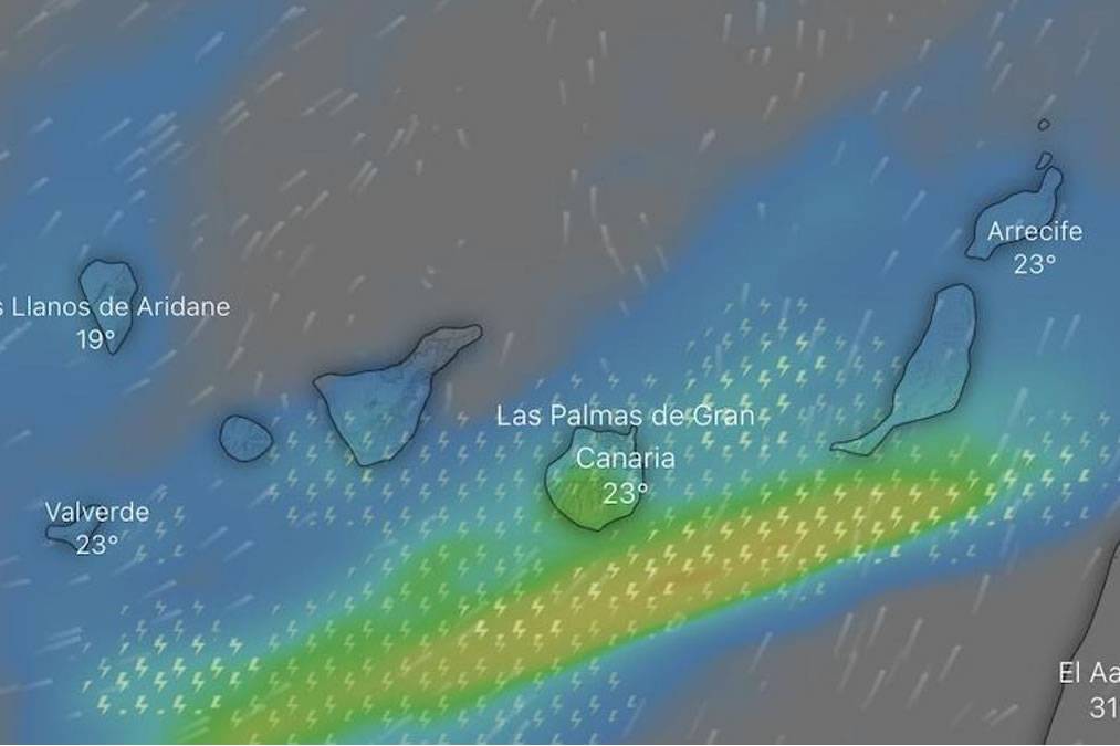
The start of June will bring ‘abundant’ rains that will affect the Canary Islands next week, especially on Tuesday and Wednesday when the arrival of an Atlantic front is expected, which could leave quite a lot of rain in the Archipelago accompanied by electrical storms.
However, more rain is expected on some islands for the remainder of the week, but generally, it will be weaker. This afternoon, Thursday 1st June, there will be cloudy intervals starting at noon, with a probability of light rain in La Palma, Tenerife, Gran Canaria, Lanzarote, and Fuerteventura.
Looking ahead to tomorrow (Friday), there will also be cloudy intervals, especially on the eastern and southern slopes, where scattered showers are forecast in La Palma, Tenerife, Gran Canaria, and Fuerteventura.
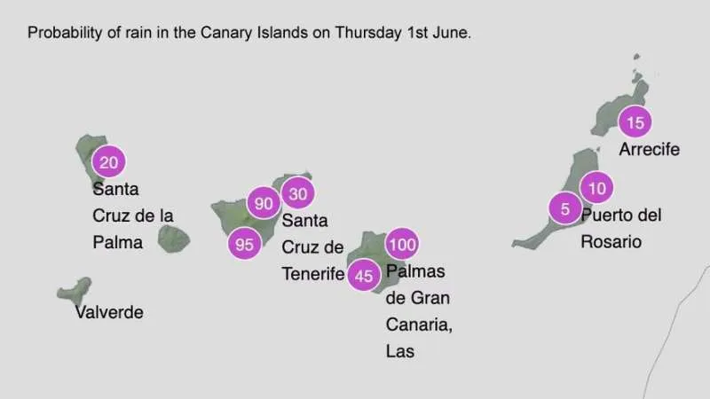
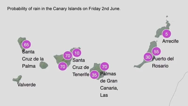
Over the weekend, there will be more clouds, particularly in the north of the more mountainous islands, and in inland areas and southeastern slopes of Tenerife and Gran Canaria, where more rain is expected.
What is the weather forecast for the next week?
The Canary Islands are expected to be affected by the arrival of an Atlantic front bringing heavy rain to the archipelago next week. The weather prediction models forecast a large amount of rainfall on Tuesday and Wednesday, which could be accompanied by electrical storms.
According to the European ECMWF model, accumulated rainfall is expected to exceed 30mm in six hours in areas of La Palma and Tenerife.
However, the forecast of the State Meteorological Agency (AEMET) could vary as the days go by given the distance from the mentioned dates, although at the moment it says that there will be variable winds, with an increase in cloudiness and the probability of precipitation due to the arrival of this front, as well as a drop in temperatures on Monday.
Other articles that may interest you...
Trending
Most Read Articles
Featured Videos
TributoFest: Michael Buble promo 14.02.2026
- 30-01-2026
TEAs 2025 Highlights
- 17-11-2025


