The 6km stone wall that divided one of the Canary Islands from coast to coast
- 29-09-2024
- Travel
- Canarian Weekly
- Photo Credit: Turismo de Canarias
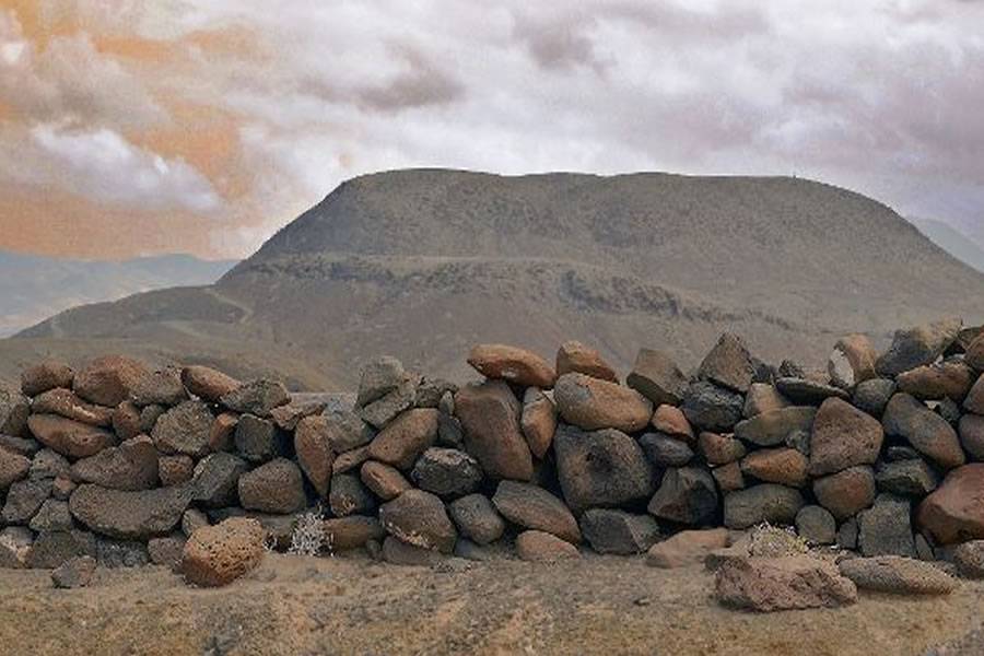
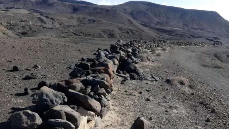
Though time has eroded much of it, remnants of La Pared, the stone wall that once split the island of Fuerteventura in two, still stand today. Originally stretching six kilometres across the narrowest part of the island, this ancient structure is a testament to how humans have long sought to control land, even in remote places like the Canary Islands.
The wall’s purpose, according to historical sources, may have been to mark territorial boundaries or manage pastureland.
Dividing the Island: The History Behind ‘La Pared’
The first known mention of this stone barrier is found in the 15th-century Norman chronicle Le Canarien, which describes Fuerteventura, or “Erbania” as it was once called, as an island divided by a large stone wall.
Stretching from Laja Blanca to Sotavento, the wall was built along the isthmus separating the two regions of the island, Maxorata in the north and Jandía in the south. Today, the small town of La Pared in Pájara takes its name from this historic feature.
Although only fragments remain, with some sections barely reaching 80 centimetres in height, the area surrounding La Pared is home to an important archaeological site that sheds light on Fuerteventura’s pre-Hispanic past.
The Wall in Historical Accounts
The chronicle Le Canarien describes Fuerteventura as “an island with a wall that stretches across the land from one sea to the other." This description highlights the geographical divide and its significance in earlier centuries.
Further insights come from René Vernau, a 20th-century anthropologist, who described the wall as an "immense structure" that once separated the rival kingdoms of Maxorata and Jandía. According to Vernau, conflicts between these regions often meant the wall served to protect inhabitants from raids and territorial disputes.
Archaeological Significance and Cultural Heritage
In 2014, the Canary Islands government declared the remnants of La Pared and its surrounding archaeological site a Bien de Interés Cultural (BIC), or Cultural Heritage Site, in recognition of its historical and archaeological importance.
The protected area covers over 328,000 square metres and includes nearly 50 adjoining structures, such as those found at Degollada de Pedro Ponce. These structures have yielded ceramic fragments with varied decorations, offering valuable clues to the island’s past.
Purpose: A Defensive Barrier or a Pasture Boundary?
Traditionally, the wall was believed to be a defensive structure separating the two regions. However, some researchers now argue that its purpose may have been more practical than political.
According to this theory, the wall was likely used to manage grazing land and protect the Jandía region’s limited resources from being overused by livestock. By confining the animals to specific areas, the inhabitants ensured that water and vegetation remained available during periods of scarcity.
While its original function may still be debated, the remnants of La Pared stand as a reminder of Fuerteventura's rich history and the ways in which its people have adapted to the island’s unique geography over time.
Other articles that may interest you...
Trending
Most Read Articles
Featured Videos
TributoFest: Michael Buble promo 14.02.2026
- 30-01-2026
TEAs 2025 Highlights
- 17-11-2025


