18 seismometers installed on the seabed between Gran Canaria and Tenerife
- 20-02-2024
- Gran Canaria
- Canarian Weekly
- Photo Credit: IGN
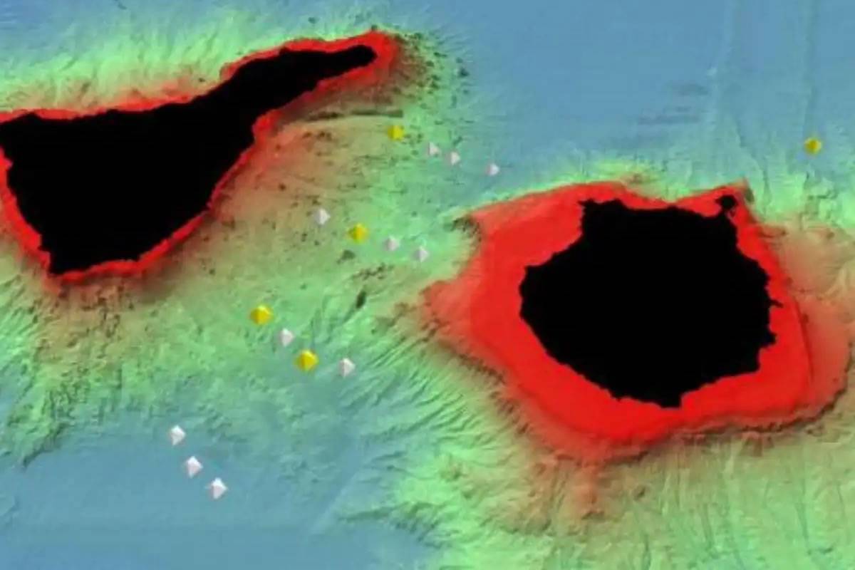
18 seismometers (OBS) have been recently installed on the sea floor of the channel between Tenerife and Gran Canaria, as well as west of Fuerteventura, to capture seismic activity with greater precision.
This initiative is part of the Guanche project, a research effort led by the National Geographic Institute (IGN) and the Institute of Marine Sciences (ICM-CSIC), aiming to understand the origin of earthquakes occurring between the two islands and identify the structure of the crust and mantle in the archipelago.
Specifically, 15 seismographs have been placed near the Enmedio volcano, in the channel between Gran Canaria and Tenerife, and three others have been situated east of Gran Canaria, using the Sarmiento de Gamboa oceanographic vessel of the CSIC.
The seismic activity data recorded by the marine stations will be analysed by researchers from the ICM in Barcelona and the Geomar Institute in Kiel, Germany, once they return to land next summer.
The underwater seismic stations will be brought ashore at the end of July. "They will be underwater for the duration of their battery life. Afterward, the data will be analysed, and by the end of the year, we should see the results," explains the director of the IGN in the Canary Islands, Itahiza Domínguez, regarding the retrieval of the devices, similar to those used on land but with special capsules to withstand the pressure at 3,000 metres deep.
The more precise data obtained from under the water will help researchers uncover the origin of the Enmedio volcano and provide new clues about the origin of the Canary Islands.
Additionally, the Sarmiento de Gamboa journey was utilised to conduct a new high-resolution bathymetry of the sea floor in this part of the archipelago. This new underwater map will contribute to linking the subaquatic morphology with the seismicity of the area.
The project, initially set to conclude in September 2025, may be extended for an additional year due to the delayed start caused by the eruption of the Tajogaite volcano in La Palma.
A total of 16 scientists are directly involved in this research, which has a budget of €300,000. IGN personnel handling the Guanche project are responsible for land-based instrumentation, including thirteen seismic stations installed in different points of Gran Canaria during the past spring.
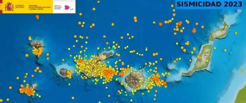
The Zone with the Highest Tectonic Seismicity: 500 per Year
The channel between Gran Canaria and Tenerife is identified as the area with the highest tectonic seismic activity in the Canary Islands with between 400 and 500 earthquakes detected annually. Understanding the reasons behind such seismicity is the key objective of the Guanche project.
The hypothesis put forth by the IGN is that there may be a fracture between Gran Canaria and Tenerife causing tension, resulting in these seismic events. This theory can be investigated through tomography, revealing the subsurface structure.
Another scientifically intriguing aspect is that the channel detects earthquakes of greater magnitude than those recorded elsewhere in the Canary Islands. One such event occurred in 1989, reaching a magnitude of 5.2 widely felt by the population.
In this regard, another goal of the study is to determine the level of danger posed by seismic activity occurring between Gran Canaria and Tenerife.
In the past year, the IGN registered 565 tremors halfway between Gran Canaria and Tenerife. Among them, the most significant earthquake recorded in the archipelago in the last year was a seismic event located west of Gran Canaria with a magnitude of 3.7.
In January of this year, 33 earthquakes were recorded in this area, further emphasizing the need for comprehensive seismic research and monitoring in the region.
Other articles that may interest you...
Trending
Most Read Articles
Featured Videos
TributoFest: Michael Buble promo 14.02.2026
- 30-01-2026
TEAs 2025 Highlights
- 17-11-2025


