
Rain forecast for the start of September in the Canary Islands
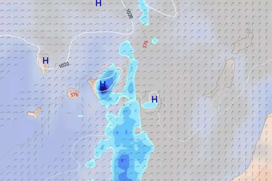
September is set to begin with a change in the weather across the Canary Islands, with rain possible on several islands during the first few days of the month, particularly in Tenerife and Gran Canaria.
Although summer is far from over in the archipelago and warm temperatures will continue, forecasts suggest increasing cloud and showers could accompany the start of September.
Winds are also expected to gradually weaken during the first week of the month, bringing the calmer conditions traditionally associated with this time of year in the Canaries.
Monday: Temperatures could reach 30°C
According to AEMET forecasts, Monday will bring cloudy conditions to northern areas, although skies should clear during the day, particularly across Lanzarote and Fuerteventura.
Elsewhere, it will be mostly sunny or clear, with temperatures remaining relatively stable.
Maximum temperatures could reach 30°C in southeast Lanzarote and Fuerteventura, southern and western mid-altitude areas of Gran Canaria, and low-lying southern parts of the metropolitan area of Tenerife.
Moderate northeast winds will continue, with stronger conditions possible on exposed slopes.
Tuesday: September begins with increasing cloud
According to the European ECMWF forecasting model, Tuesday 1st September will initially be similar to the final days of August, with predominantly clear skies and little prospect of rain during the first half of the day.
However, cloud is expected to increase during the afternoon, particularly across the central islands, potentially producing some rainfall over mountainous parts of Tenerife and Gran Canaria.
AEMET forecasts little change in minimum temperatures, while daytime temperatures could rise slightly, particularly inland and in southern areas.
Wednesday: Rain forecast for Tenerife
Conditions could become more unsettled on Wednesday as cloud increases during the day.
The European model currently indicates the possibility of rain across much of Tenerife from mid-morning, with the largest accumulations forecast around central areas and southern-facing slopes.
Rain is also possible across central and western Gran Canaria, although generally in smaller amounts.
Aemet is currently forecasting cloudy conditions in northern areas of the islands, becoming more broken from midday, while elsewhere it should remain mostly clear.
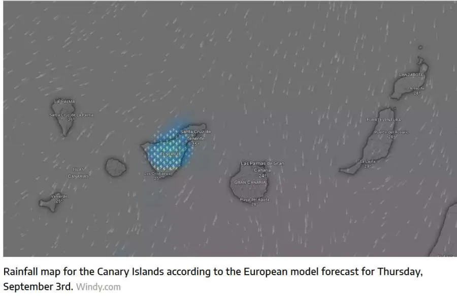
More showers possible on Thursday and Friday
Cloudy conditions are forecast to continue into Thursday, with further showers possible, particularly in Tenerife.
Northerly winds are expected to continue but should begin losing strength across the western islands.
By Friday, winds are forecast to weaken further, bringing the calmer conditions commonly experienced in the Canary Islands at this time of year.
There will, however, remain a possibility of rain in both Tenerife and Gran Canaria, with Tenerife currently expected to see the greater chance of showers, particularly across central and eastern parts of the island.
As the forecast is several days ahead, conditions and expected rainfall amounts may change as the week approaches.
Despite the possibility of showers, September remains part of the summer season in the Canary Islands, and temperatures are expected to remain warm.
Share: